Visualization for Urban Design and Transportation
Over the past ten years I’ve combined my love of working in game engines with my ever-growing interest in urban design and transportation - specifically active transportation, like bicycling and walking. This culminated in a fantastic job since 2020 at the firm Toole Design, where I’ve created a huge amount of work in Unity and Unreal, as well as rendering engines like Lumion and more traditional viz tools like Sketchup and Illustrator. Then I edit and create graphics for animations using Adobe Premiere and After Effects, or sometimes export interactive visualizations from Unity for use on websites via WebGL.
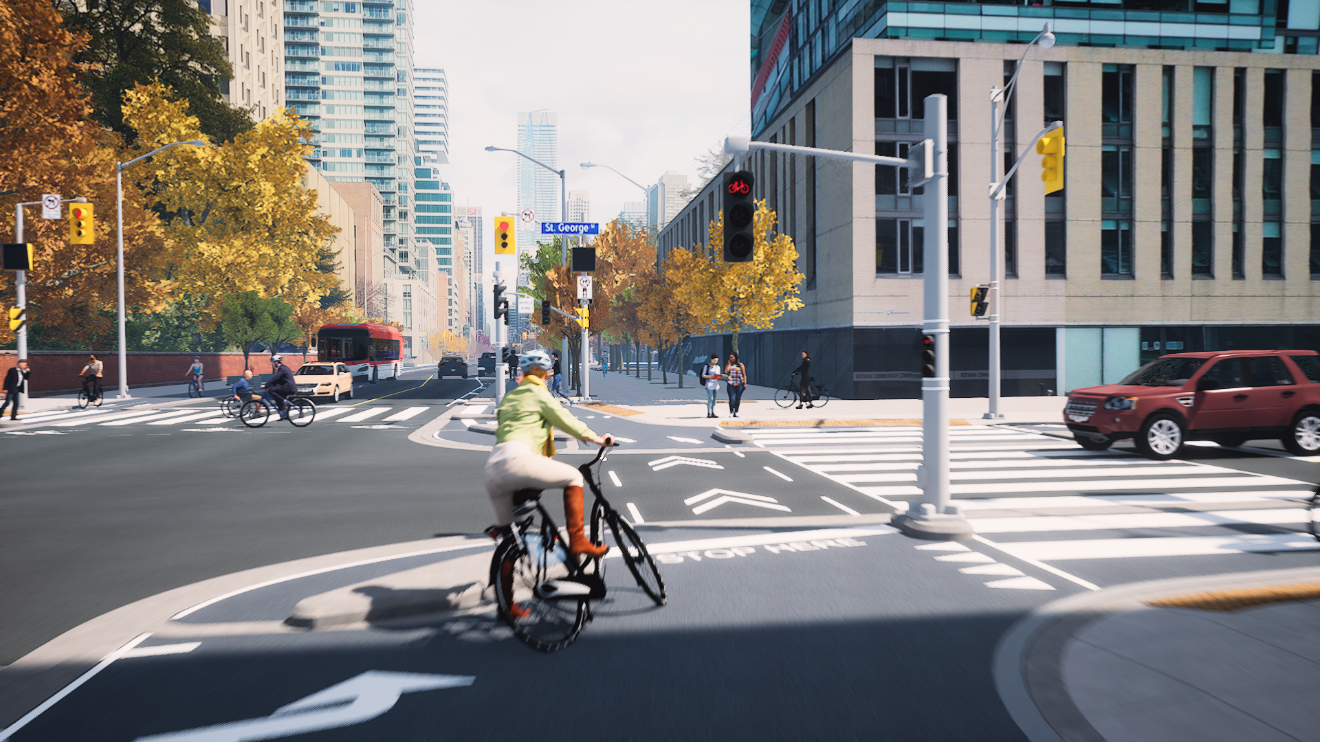
Unreal Visualization: Bloor Street, Toronto
Unreal Engine rendering using RTX-powered real-time raytracing for effortless naturalism
Created buildings from satellite photo, street infrastructure from CAD drawing; cars, people, trees and other entourage from found collections
Camera animation via Sequencer

Unreal Engine flythrough of Toronto's Bloor Street; context based on a drone reference photo; street design extruded from a CAD drawing - 2021

Unreal flythrough of a safer new "protected intersection"; camera animated via Sequencer; lighting via real-time ray tracing; stock entourage models and characters - 2021
Unreal Visualization: Mobility Hubs
Flythrough that introduces the viewer to elements of a “mobility hub,” where various transportation modes cross paths to the benefit of the local community and economy
Unreal Engine rendering using RTX-powered real-time raytracing
Camera animation via Sequencer
Mainly used found assets


Unity Visualization: Baltimore Complete Streets Manual
Unity animation presenting Baltimore's new Complete Streets Manual to the public
Animation sequenced in Timeline with Unity plugin "Flat Kit" used for rendering
Unity Interactive Visualization: Hailey, Idaho
Built for City of Hailey, Idaho and Project for Public Places to explore options for main street redesign
Created in Unity, with Playmaker visual scripting asset
Use controls to change street designs and change camera POVs; right-click to orbit